Nationwide Service | Houston Headquarters
Nationwide Existing-Condition Documentation
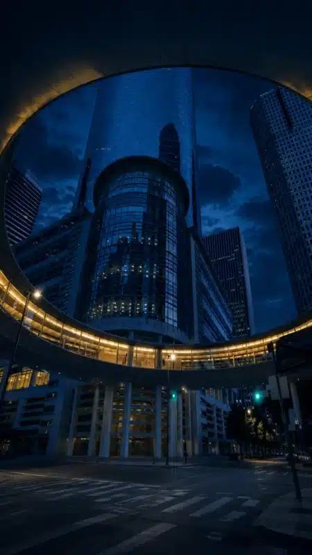
3D Laser Scanning Services & Existing-Condition Documentation for Buildings, Facilities and Infrastructure
Reality IMT supports projects ranging from individual buildings and equipment areas to large facilities, multi-site portfolios, and infrastructure programs with coordinated 3D laser scanning services and existing-condition documentation.
30M+ SF
Buildings documented
2,000 Miles
Corridors mapped
Nationwide
Field deployment
20+ Years
Combined project experience
Why Clients Choose Reality IMT
1
Field-to-Deliverable Coordination
Field capture, point-cloud processing, CAD, BIM, GIS, reports, and visual documentation are coordinated through one connected workflow.
2
Project-Specific Documentation
Scopes are built around intended use, required accuracy, software environment, access conditions, and schedule.
3
Complex Environments
Experience includes occupied buildings, industrial plants, campuses, public assets, corridors, and rail environments.
4
Individual Sites to Large Programs
Reality IMT supports one-building assignments, complex facilities, multi-site programs, and long linear infrastructure corridors.
From Field Capture to Usable Project Documentation
Reality IMT converts field-verified existing-condition data into deliverables that support design, renovation, construction, facility planning, asset management, and infrastructure programs.
Field capture → point-cloud processing → CAD, BIM, GIS and reporting
Core Existing-Condition Documentation Services
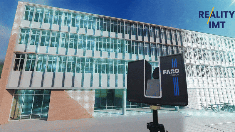
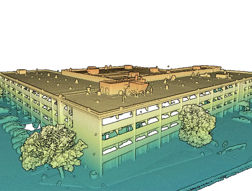
3D Laser Scanning
High-density reality capture for buildings, industrial facilities, equipment areas, infrastructure, and complex existing conditions.
Explore 3D Laser Scanning Services
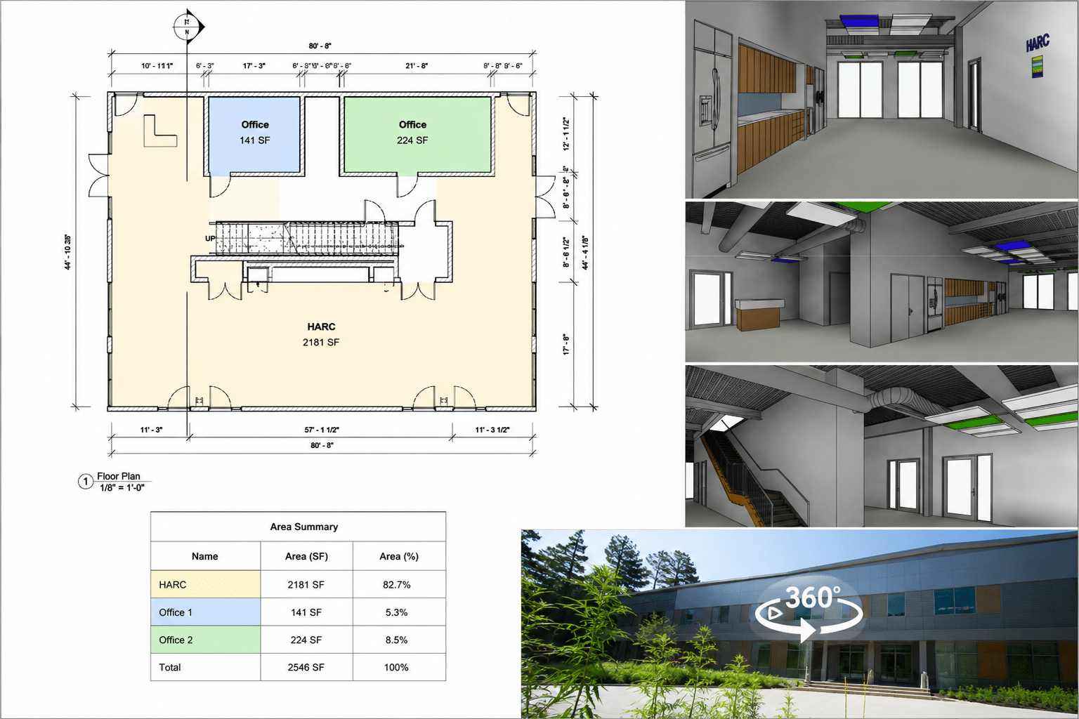
Building Documentation & Floor Plans
Field-verified measurements, floor plans, area documentation, and building records for owners, CRE teams, and project stakeholders.
View Building Documentation Services
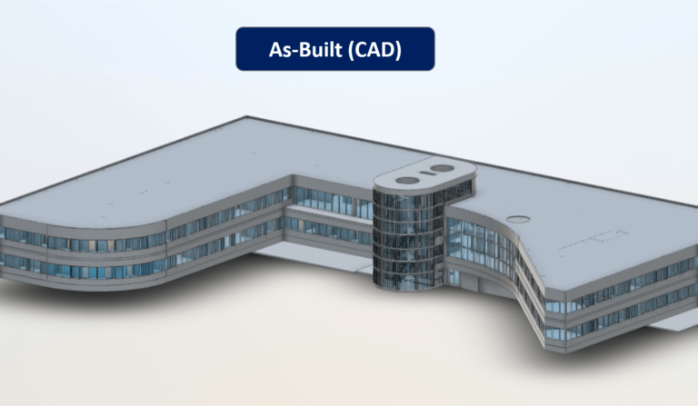
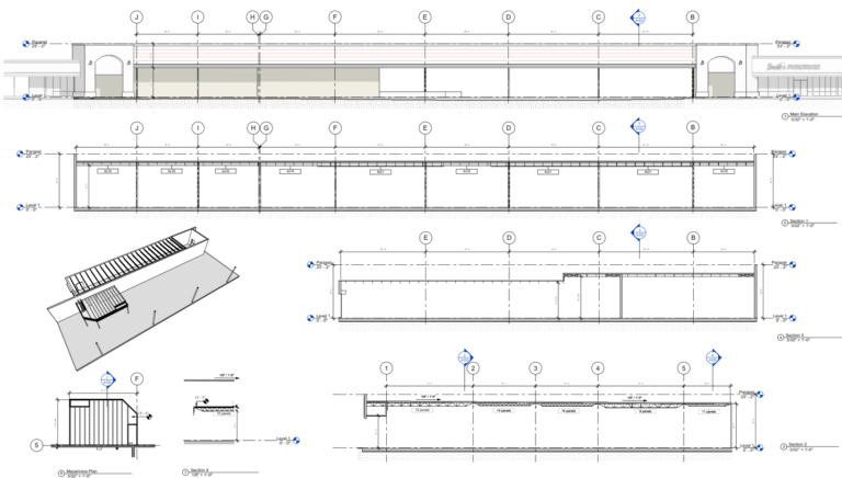
As-Built Drawings & CAD
Existing-condition CAD and DWG drawings, including plans, elevations, sections, and reflected ceiling plans.
Explore As-Built Drawings & CAD Services
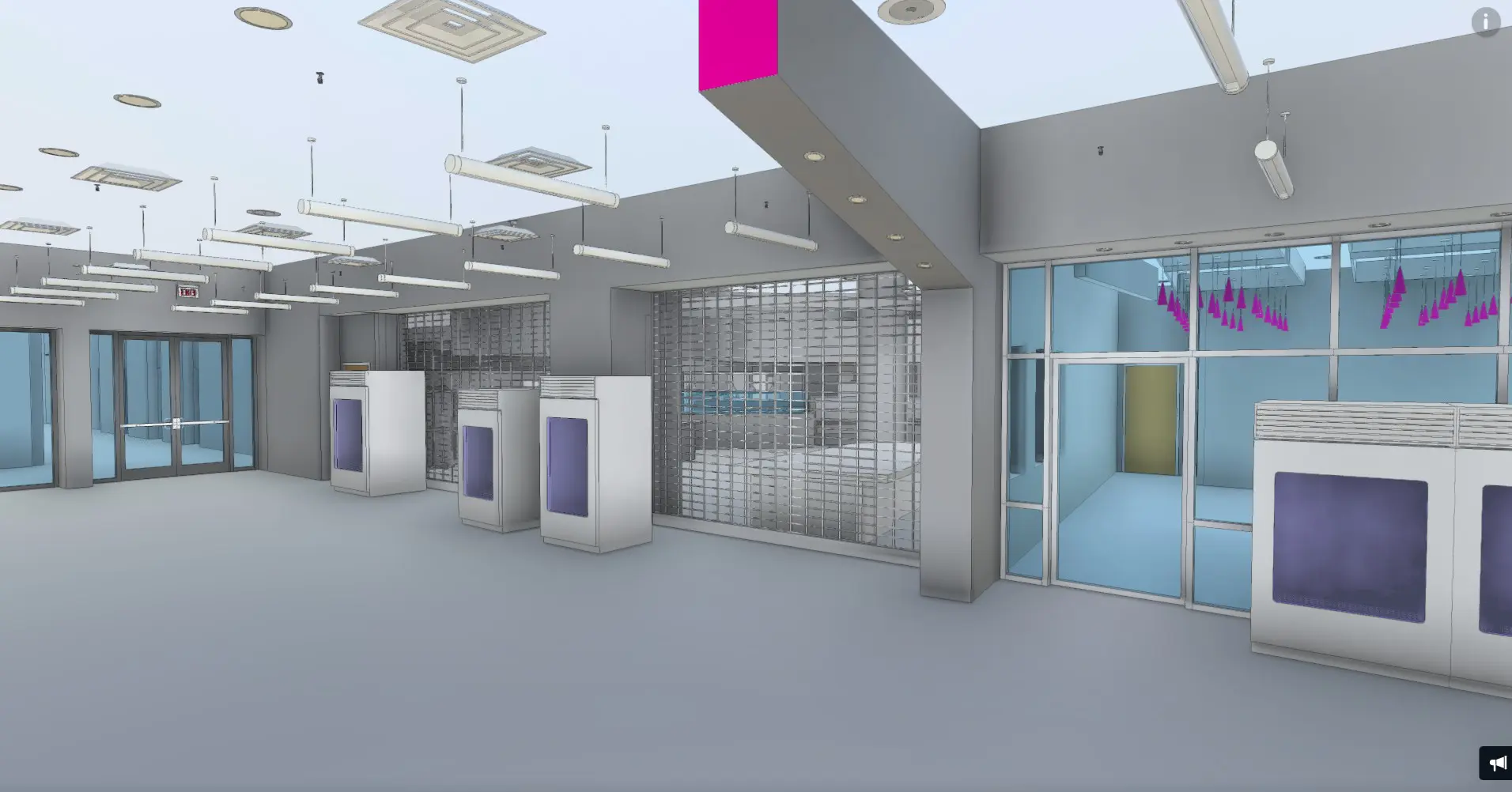
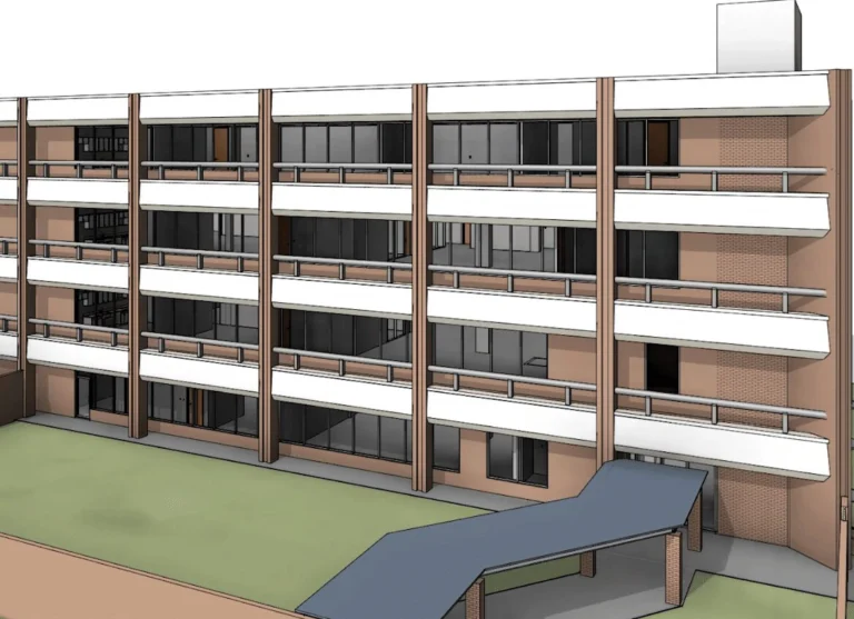
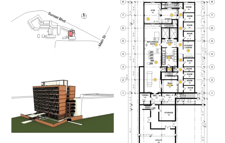
Scan-to-BIM / Revit Modeling
Existing-condition Revit models developed from point-cloud data for design, renovation, coordination, and planning.
View Scan-to-BIM Services
Infrastructure & Corridor Mapping
Mobile LiDAR, imagery, GIS data, roadway documentation, asset extraction, and linear corridor mapping.
Explore Corridor Mapping Services
Rail Mapping
Hi-rail LiDAR, asset inventories, georeferenced imagery, GIS databases, and railway corridor documentation.
Explore Rail Mapping Services
Documentation for Projects of Different Sizes
Reality IMT supports individual renovation projects, occupied facilities, industrial equipment areas, multi-building campuses, commercial portfolios, and large infrastructure programs.
Individual Buildings & Renovations
For architects, owners, contractors, and real estate teams needing measurements, point clouds, floor plans, CAD drawings, or Revit models.
Facilities & Complex Sites
For facility managers, industrial operators, institutions, and public agencies managing complex existing conditions.
Portfolios & Infrastructure Programs
For multi-site operators, program managers, transportation agencies, and owners requiring repeatable standards across many locations or long corridors.
Industries & Project Teams We Support

Architects & Engineers
Existing-condition CAD, Revit, point clouds, and visual records supporting renovation and design.
Explore Services for Architects & Engineers
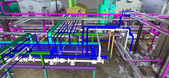
Oil, Gas & Petrochemical
Reality capture and documentation for process facilities, equipment areas, structural systems, and modifications.
Explore Services for Oil, Gas & Petrochemical

Municipal & Public Sector
Documentation for public buildings, roads, utilities, transportation infrastructure, and capital programs.
Explore Services for Municipal & Public Sector
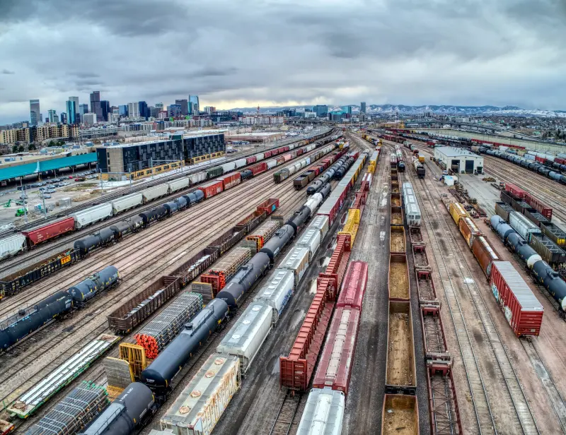
Rail & Transit
Rail corridor mapping, GIS asset inventories, georeferenced imagery, and station documentation.
Explore Services for Rail & Transit
Commercial Real Estate
Existing-condition documentation for office buildings, retail centers, mixed-use developments, renovations, lease planning, and capital improvement projects.
Explore Services for Commercial Real Estate
Facility Managers & Building Owners
Accurate CAD, BIM, and existing-condition documentation supporting maintenance, renovations, equipment upgrades, and long-term facility management.
Explore Services for Facility Managers & Building Owners

Industrial & Manufacturing
Reality capture and documentation for manufacturing facilities, equipment, piping systems, production areas, and plant modifications.
Explore Services for Industrial & Manufacturing
Retail & Multi-Site Programs
Standardized scanning and documentation services supporting store rollouts, renovations, facility planning, and multi-location asset management.
Explore Services for Retail & Multi-Site Programs
Selected Project Experience
13 Sep 2018
Bissonnet Office Building Architectural As-Built Documentation
Reality IMT provided building documentation for this office building totaling approximately 70,000 SF in Houston,…
5 Oct 2021
Highway 6 Retail Center Structural As-Built Survey
Reality IMT provided structural as-built documentation for this retail building totaling approximately 43,000 SF in…
10 Feb 2019
TXDOT Building Laser Scanning & Architectural As-Builts
Reality IMT provided 3d laser scanning for this government office / public facility totaling approximately…
3 Aug 2024
Rice University Campus Revit As-Built Documentation
Reality IMT provided scan-to-bim for this university / campus totaling approximately 108,000 SF in Houston,…
Planning an Existing-Condition Documentation Project?
Buildings, industrial facilities, campuses and infrastructure programs.
Project-Specific Reality-Capture Technology
Reality IMT selects the appropriate capture technology based on the project environment, required accuracy, coverage, access constraints, and intended deliverables.
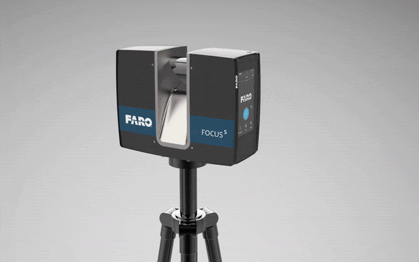
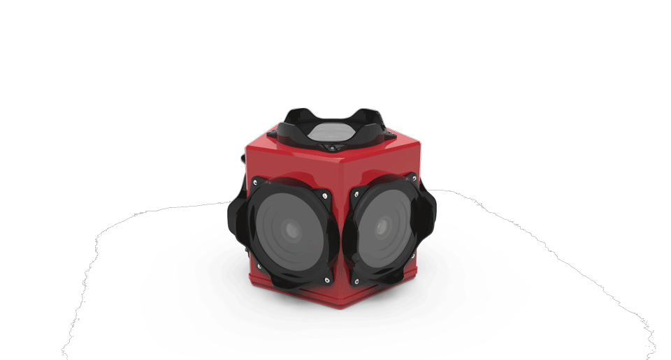
Terrestrial 3D Laser Scanning
High-density capture for buildings, facilities, industrial systems, and detailed existing-condition documentation.
360° Imagery & Visual Records
Project-organized visual documentation supporting remote review, context, and reduced repeat visits.
Mobile LiDAR & Corridor Mapping
Efficient mapping for roadways, rail corridors, utilities, streetscapes, and long linear infrastructure.
See What Reality IMT Delivers
Point Clouds
Registered, measurable scan data for review, modeling, coordination, and documentation.
Floor Plans & CAD
Floor plans, elevations, sections, reflected ceiling plans, and DWG files.
Revit & BIM Models
Existing-condition models developed for renovation, design, coordination, and planning.
GIS, Reports & Visual Records
Asset inventories, GIS datasets, reports, imagery, 360 references, and project records.
Our Existing-Condition Documentation Process
1
Define Scope
Confirm project area, intended use, access, accuracy, deliverables, and schedule.
2
Capture Conditions
Scan, measure, photograph, or map the required areas.
3
Process & Verify
Register data, organize imagery, apply control, and complete QA/QC.
4
Develop Deliverables
Create CAD, floor plans, Revit models, GIS data, reports, or visual records.
5
Deliver & Support
Provide organized files and support the client review process.
Nationwide Project Coverage with Regional Service Areas
Reality IMT is headquartered in Houston and supports projects throughout the United States. Dedicated service-area pages provide local information for Houston, Dallas–Fort Worth, Austin, San Antonio, and Atlanta.
Organizations & Project Teams Supported


Planning a Building, Industrial, or Infrastructure Documentation Project?
Send us the project location, approximate size or corridor length, site conditions, required deliverables, and schedule. We’ll review the scope and recommend an appropriate capture and documentation approach.