When it comes to measuring and documenting building floor plans, there are several factors to consider, including time, cost, and accuracy. Fortunately, the introduction of 3D building scanning technology has transformed the way we measure and document buildings. This article will discuss the importance of accurate building measurement services and 3D building scanning services and how they can help Architects, Engineers, Building Owners, House Owners, and Facility Managers get the most out of their projects.
The Role of a Building Surveyor
Building surveyors play a crucial role in accurately and quickly measuring buildings. They begin by studying historical data, including old floor plans, estimated square footage, location, photos, etc. This initial study helps determine the time and cost of the project and the BIM modeling requirements. Building surveyors then draft a diagram showing potential scan locations indoor and outdoor, which is used as a reference for field data collection. This preparation ensures that the field data collection is completed quickly and accurately.
The Instrument: 3D Building Scanner
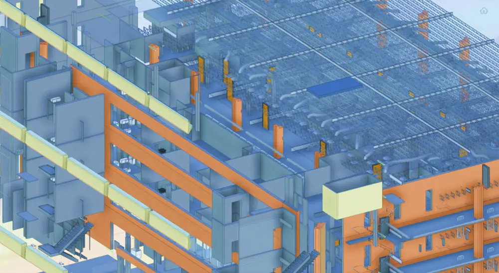
3D building scanners are essential tools for building surveyors. There are several types of 3D scanners available in the market that can be used for buildings, and they mainly differ in speed, range, and quality. Lieca and Faro are two known companies in the industry that manufacture 3D laser scanners, and their RTC 360 and S-150 instruments can perform a single scan with similar time, range, and accuracy. Terrestrial scanners can cover an estimated area of 70,000 sqf in one day, making them ideal for scanning larger buildings.
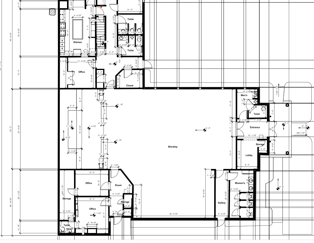
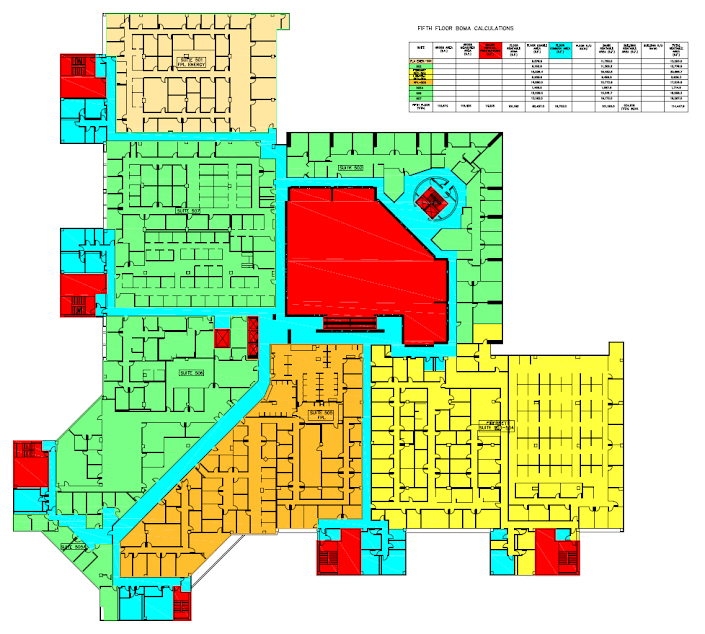
The Deliverable: Floor Plan Measurement
Once the building measurements are collected in the field, the data is brought back to the office, where a team of BIM modelers start to process the point measurements and convert them into vector files (CAD) in 2D or 3D depending on the project requirements. The BIM modeling team takes around four days to complete the entire model of a 70,000 sqf building. The result is an accurate, floor plan measurement with building elevations, reflected ceiling plans, and a site plan.
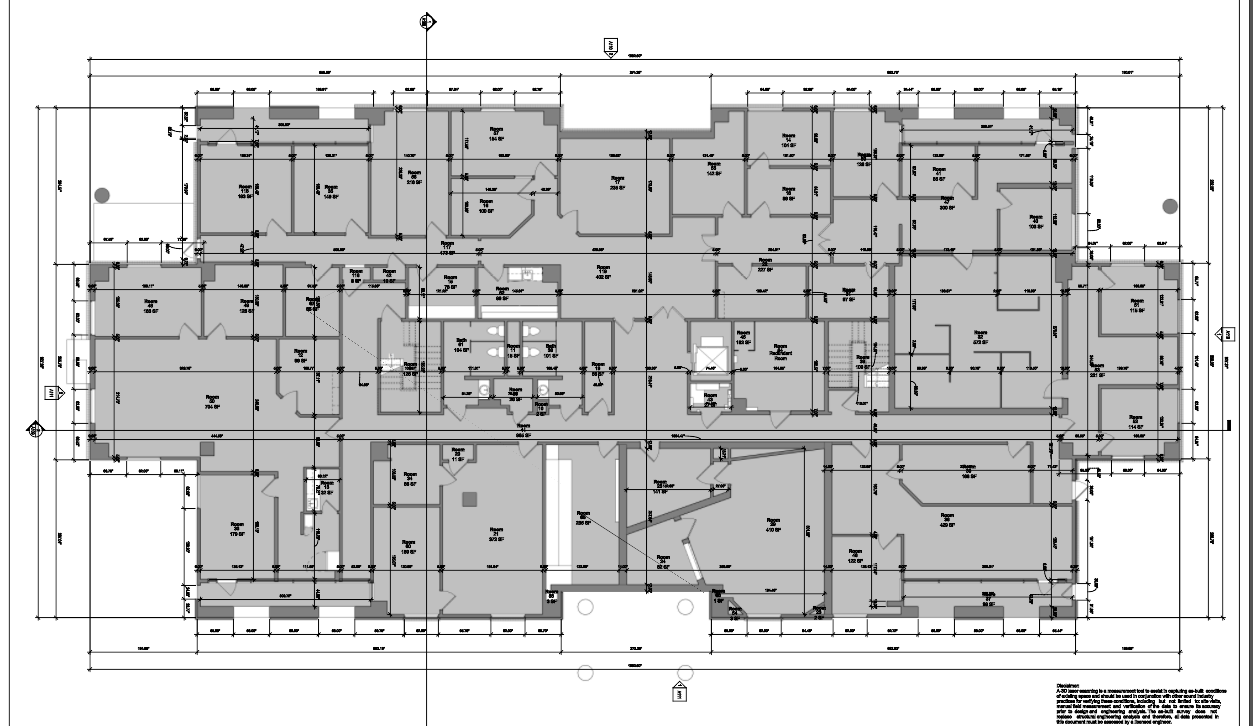
Case Study: Office Building in Austin, TX
Reality IMT recently completed a project to scan an office building in Austin, TX, located. The client needed an accurate and fast floor plan measurement of the building, which is spread over 60,000 sqf. Reality IMT used the Leica RTC 360 terrestrial scanner to complete the project in two days, which included data processing and modeling. The result was an accurate BIM model that included floor plan measurements, elevations, reflected ceiling plans, and a site plan.
Conclusion
3D building scanning technology has transformed the way we measure and document buildings, providing a more accurate, fast, and cost-effective solution. Building surveyors play a vital role in ensuring accurate building measurement services, and 3D building scanning services are used to deliver accurate floor plan measurements. With the use of 3D building scanning technology, Architects, Engineers, Building Owners, House Owners, and Facility Managers can get the most out of their projects.