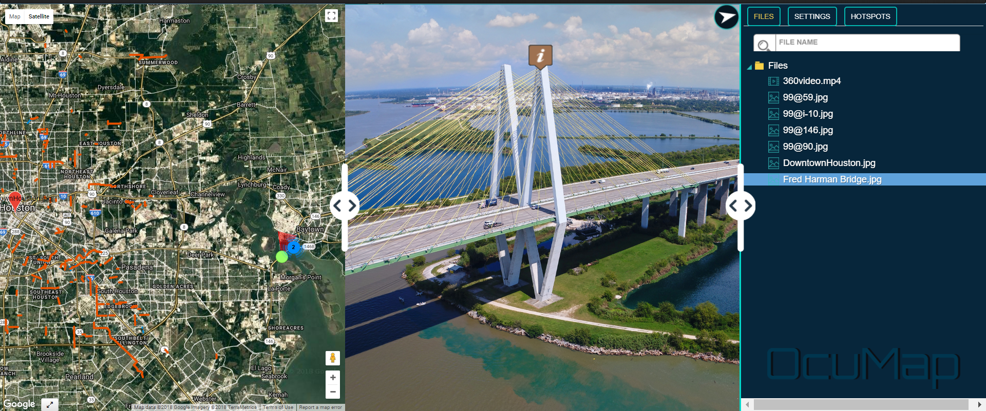
Aerial 360 Mapping-Highway 99 Expansion
According The Texas Department of Transpiration, State Highway 99 (the Grand Parkway) is a proposed 180-mile circumferential highway traversing seven counties in the Greater Houston area. Conceptualized in the early 1960s, it is divided into 11 segments designated A through I-2.
Segment B is an environmentally approved (not yet constructed) 28-mile, four-lane, controlled access toll road with intermittent frontage roads from I-45 South (the Gulf Freeway) in League City toward SH 35 in Alvin and on to SH 288 (the South Freeway) near Rosharon through Galveston and Brazoria counties. Construction has not been scheduled yet.
Reality IMT captured aerial 360 degree imagery and aerial geo-video showing the proposed rout to help planners allocate resources and plan project execution.
Take a look at this aerial 360 imagery tour.