Related case study: Locating Utility Poles From Street Level Imagery Over 30,000 Circuit Miles
Electricity makes the world go round, and without it, our daily lives would look quite different from today’s reality. As more of humanity moves towards big cities and the demand for mass amounts of power increases, however, it becomes more and more difficult to adequately meet the demand with the rather antiquated systems in use today. This will be increasingly true as sustainable and renewable energy becomes non-negotiable. The solution? An electrical grid revolution.
Countries all around the world are reimagining their electricity grid in an effort to reduce power outages, limit intentional electrical disruptions triggered by bad actors, and lower energy bills for consumers. This is done using next-gen technology designed to strengthen the grid while utilizing cleaner and less expensive energy wherever possible. Before substantial changes to how we provide and consume power can be made, however, an accurate inventory of large-scale networks must be completed.
The good news is that taking an accurate asset inventory of infrastructure doesn’t have to be an impossible task for electric grid companies investing in electric grid enhancement projects. Geographic information systems (GISs) such as street-level imaging and LiDAR technology can make the process as straightforward and easy as possible.
Time and labor savings
In the past, electrical asset management has been a difficult task. With miles of electrical lines and equipment, including pole installation and repair and other surface features, keeping tabs on infrastructure has been an immense and never-ending process. More specifically, it has been a time and cost-intensive chore accomplished by utilizing field crews to collect data and manually inventory it. It is no surprise that many operators have fallen behind in this area.
Working with LiDAR and street imaging technology is a game changer in this regard. No longer must operators send large numbers of field agents out for days at a time and pay for all of the associated costs of doing so. Instead, inventory can be taken while simply driving down the road. The potential cost and labor savings to electric grid companies are immense, and the process is just about as simple as it sounds.
GIS technology
Street imaging and LiDAR technologies are highly efficient and cost-effective solutions to asset management. The process reduces the amount of time spent in the field and actively collecting data and therefore makes maintenance and inventory assessment surprisingly simple.
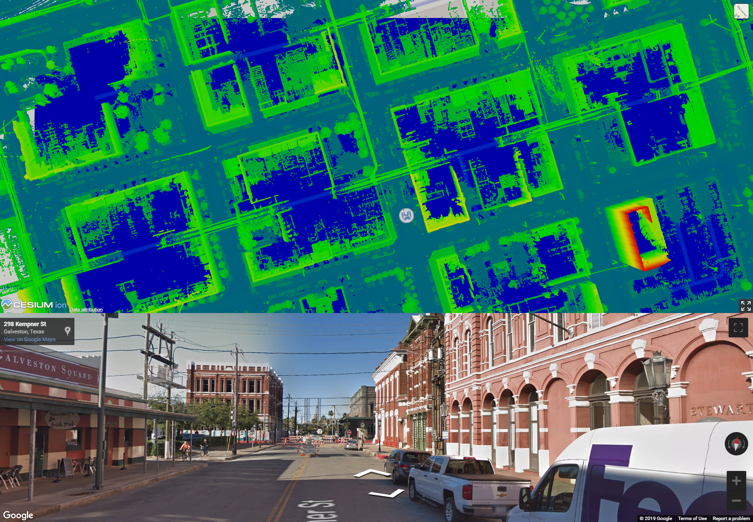
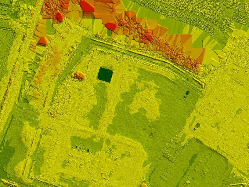
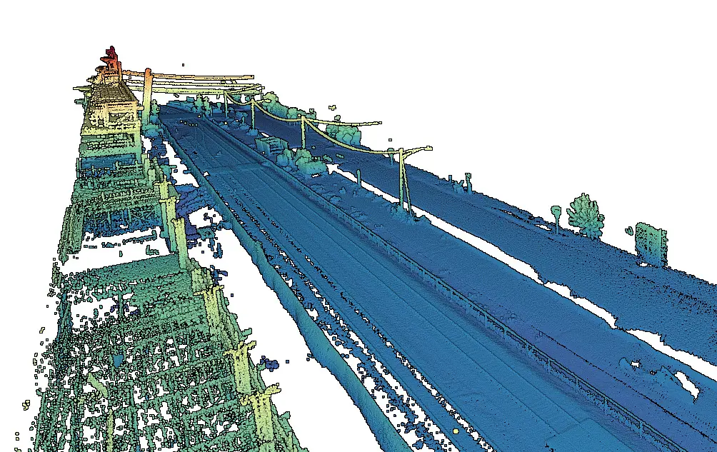
Street-level imaging using mobile LiDAR mapping technologies is easy. Once a vehicle has been equipped with the proper equipment, operators simply drive down the street. That’s it! The data is collected in a process similar to Google Street View. As the cars drive down the street, cameras and other drive-by imagery equipment attached to them capture data about the electrical grid equipment they pass. Once this data has been captured, it is carefully processed in order to ensure accuracy and then imported into GIS. The features are then extracted based on location and used to generate accurate geodatabases.
Once databases have been generated, they are sent back to clients with pictures indicating the location of every pole.
Real world results
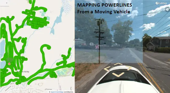
Reality IMG recently completed a large-scale powerline mapping project for a client responsible for modernizing and maintaining an electrical utility grid containing an estimated 30,000 circuit miles. Features such as poles, phase markers, ID tags, and equipment on poles needed to be located on the fly in order to complete a GIS study regarding the number of miles on road vs. offroad. The client has a 30-day timeline.
Our crews used mobile mapping vehicles with RTK GPS and omnidirectional cameras to capture electric grid inventory data. Captured data was transferred to the office daily so that the data processing team could work on it immediately. The result was an up-to-date GIS database with 80% of circuit miles mapped within a 30-day period, a task that would have previously taken at least two years to complete prior to the use of LiDAR and street imaging technologies.
After data is captured, it is processed for improved accuracy and then imported into GIS where the features are extracted based on Location.
A geodatabase is then generated and sent back to the client with pictures showing where every pole is located.